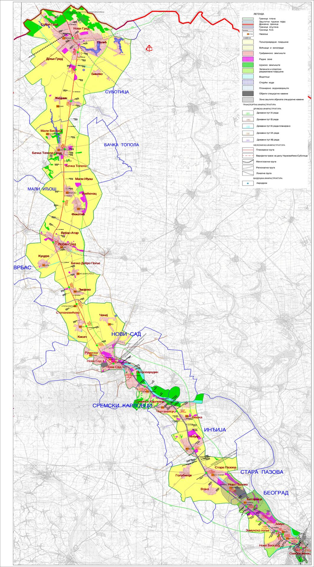
Spatial plan of the special purpose area of the Belgrade – Subotica – State border (Kelebija) railway infrastructure corridor
The Spatial plan was developed to create conditions for modernization of the Belgrade – Subotica – State border (Kelebija) railway line, which is part of the Project of railway line through Hungary and Serbia, in accordance with the Memorandum of understanding and cooperation for the Project of Hungarian-Serbian railway connection signed between the National Development and Reform Commission of the People’s Republic of China, the Ministry of Foreign Affairs and Trade of Hungary and the Ministry of Construction, Transport and Infrastructure of the Republic of Serbia. Reconstruction of the existing single-track line and construction of another track will enable formation of modern high-performance double-track line for combined (passenger and freight) transport and speed up to 200 km/h. Modernized railway line shall enable commercial speed of 130 km/h of the fastest passenger trains, which will allow for reduction of traveling time between Belgrade and Budapest. In addition to the speed, a modern double-track line shall enable high level of safety, capacity and comfort in passenger and freight transport. The area covered by the Plan is 199 364 ha approximately. The railway line includes three characteristic sections, which are specifically presented and described in the Plan: The Belgrade Centre – Stara Pazova section, about 34 km long, the Stara Pazova – Novi Sad section, about 40 km long, and the Novi Sad – Subotica – State border (Kelebija) section, about 107 km long.
Client
Republic of Serbia, Ministry of Construction, Transport and Infrastructure
Location
Belgrade - Subotica - State border (Kelebija)
Period
2016.
Engaged teams


